URBAN CLIMATE. LIVING INFRASTRUCTURE.

Cooler cities.
Start beneath
the surface.

We connect satellite data, landscape planning and root-zone technologies to help trees establish, thrive and make urban spaces more liveable.

From satellite to root
LANDSCAPE · TREES · SOIL · WATERExplore our work
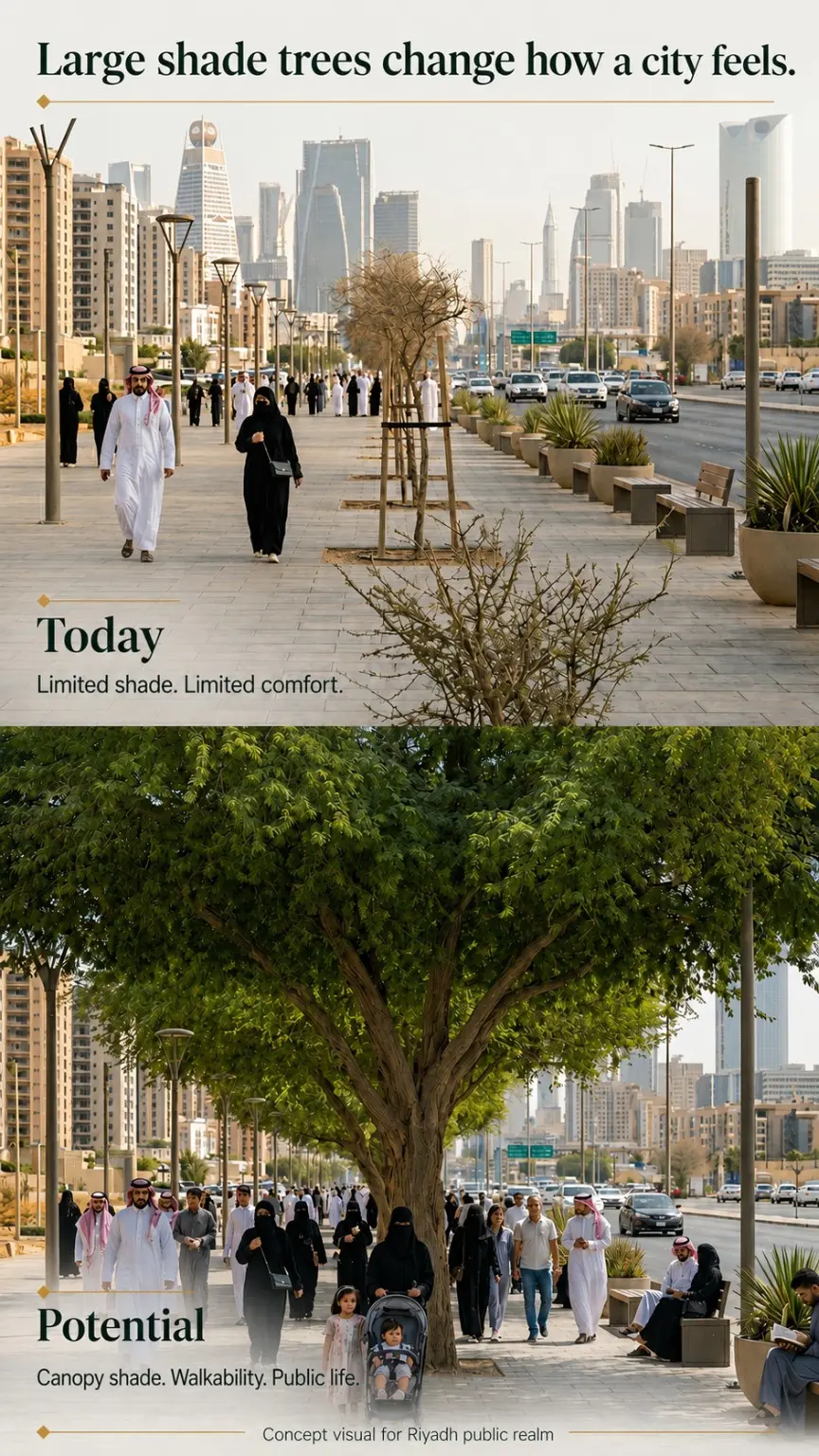
Concept visual for a public space in Riyadh, with a large tree canopy shading the pedestrian area
01 / URBAN RESILIENCERIYADH

More shade.
More life in the city.

CONCEPT VISUAL · A POSSIBLE FUTURE
FOR PLACES THAT NEED TO PERFORM

Cities & municipalities Developers Design teams Technical partners

01 — OUR APPROACH

From satellite
to root.

The map shows where to look.
The site reveals what to do.

Urban Climate Institute brings together urban climate analysis, landscape planning and the conditions trees need for long-term survival. We connect the city-wide perspective with what happens in the root zone.

Our approach turns this understanding into a clear sequence of decisions: identify priorities, assess the site, design an intervention and track its performance.

  1. 01

    Read the landscape

    Map surface heat and vegetation, interpret the urban context and identify areas for closer assessment.

    PRIORITY MAP
  2. 02

    Assess the site

    Assess trees, soil and water availability. Connect patterns on the map with conditions on the ground.

    FINDINGS & RECOMMENDATIONS
  3. 03

    Design the response

    Develop guidance for canopy retention, new planting and targeted soil, water and root-zone interventions.

    INTERVENTION CONCEPT
  4. 04

    Track the change

    Establish a baseline, agree on indicators and define a monitoring plan around the pilot’s objectives.

    PILOT & EVALUATION

02 — CLIMATE INTELLIGENCE

Make urban heat
visible.

Satellite imagery reveals patterns of surface heat and vegetation. We interpret these alongside the urban fabric to guide field assessment and identify priorities for action.

Discuss your site
ZADAR / MUSAPSTANLST + NDVI 02 AUG 2026
ONE CITY. TWO LAYERS OF INSIGHT.

Landsat 8 and Sentinel-2C imagery acquired on the same day. LST shows land surface temperature; NDVI provides a vegetation signal. Together, they guide further spatial analysis and field assessment.

HeatWhere are surface temperatures highest?

VegetationWhere is vegetation present, and where is it missing?

PrioritiesWhere should canopy be protected or intervention prioritised?

LST measures surface temperature, not air temperature. NDVI does not directly measure tree canopy cover or diagnose individual trees. Interpretation depends on acquisition date, image resolution and site conditions.

Data and interpretation
Acquisition date and time
2 August 2026
Landsat 8: 11:40 · Sentinel-2C: 12:00, local time (CEST).
Spatial resolution
LST: 100 m thermal resolution, resampled to a 30 m grid.
NDVI: 10 m.
Sources
USGS Landsat 8, Copernicus Sentinel-2 / Microsoft Planetary Computer. Indicative Musapstan boundary: © OpenStreetMap contributors.

The layers have different resolutions and should be compared as spatial patterns. Resampling to a 30 m grid does not add detail to the original thermal measurement. Grey indicates no valid data.

03 — SOIL, WATER & ROOTS

Better conditions below.
Lasting benefits above.

A thriving canopy starts with a functioning root zone. We connect spatial analysis with practical systems for tree establishment and revitalisation.

URBAN TREES & REVITALISATION01

Herbafertil®

Give roots the conditions to thrive.

Herbafertil’s functional substrate and the Drill 2 Fill method focus on soil structure, aeration and moisture availability around tree roots. Each application is tailored to the tree and the conditions on site.

  • Support for stressed existing trees
  • Compacted and constrained urban soils
  • Support for new tree planting
Explore Herba Fertil
HOT & DRY LANDSCAPES02

AquaVault™

Keep water where roots need it.

AquaVault combines root-zone support, deep water delivery and protection from surface heat and evaporation. It is designed to help trees establish in arid and water-stressed environments.

  • More efficient use of water
  • Root-zone protection
  • Pilot applications and monitoring
Explore AquaVault

AQUAVAULT RESOURCE ISLAND

One tree.
A connected soil and water system.

Concept visual showing the system and components in development. The final design is adapted to local soil, water, tree species and project objectives.

04 — WHAT WE DELIVER

Every site needs
its own response.

From an urban district to an individual site, we agree on the scope, the question to answer and the outputs your team needs to make its next decision.

Analysis can be a standalone service or the first step towards a field assessment, landscape concept or pilot project.

01

Cities and public spaces

Where should existing canopy be retained, where should new trees be planted, and which sites need attention first?

  • Surface heat and vegetation maps
  • Priority areas for field assessment
  • Key findings and guidance for municipal or project teams
02

Development and landscape projects

How can shade, soil and water inform the project from the outset?

  • Site, solar exposure and wind analysis to suit the project scope
  • Landscape concepts with planting and water-management guidance
  • Visualisations that support informed decisions
03

Arid and water-stressed landscapes

How can planting conditions be improved and performance assessed on site?

  • A site-specific AquaVault application concept
  • A pilot plan with baseline measurements and a comparison treatment
  • Monitoring indicators: water use, soil moisture and temperature, and tree development

05 — EXPERTISE IN COLLABORATION

A city-wide perspective.
Grounded in field experience.

LANDSCAPE & CLIMATE INTELLIGENCE

Bruno Jelinić

Landscape design, satellite-based heat and vegetation analysis, and the translation of spatial data into design decisions.

Dandelion Studio · collaborating specialist, Herba Fertil

TREES & ROOT-ZONE TECHNOLOGIES

Maks Udov

Field experience in tree planting and revitalisation, alongside the development and application of Herba Fertil and AquaVault systems.

Herba Fertil

LET’S START WITH YOUR SITE

Where would you
like to make a difference?

Tell us where your project is and what you want to address. Include any photographs, plans or other information you have. We will use these to agree on a practical first step.

Discuss your project

LANDSCAPE & ANALYSIS · BRUNO JELINIĆdan.delion.studio.hr@gmail.com

TECHNOLOGY & APPLICATION · HERBA FERTILherbafertil@gmail.com

URBAN CLIMATE INSTITUTE

Full image

Open full-size image ↗